 .
.A warm spring is a spring with a temperature which is above the typical cold spring temperature for the area and below typical human body temperature. Water temperature sampling apparatus consisted of an insulated plastic tumbler and a dial thermometer with 2 degrees Fahrenheit increments.

While the idea for this field trip was to locate and measure the temperature of the warm spring, the temperatures of nearby cold springs were needed to provide a control temperature, the typical climate-dependent deep well temperature for the local climate. Fortunately southern Missouri has an abundance of springs. Here is a list of fifteen large springs in Missouri from the Missouri Department of Natural Resources. We sampled cold spring temperatures at five of them: Big, Greer, Alley, Round, and Maramec.

The first temperature sample was taken 2019-05-25 at Big Spring, 56 degrees Fahrenheit at 4:00 PM. Photo is of the larger of two above surface flows from the bluff. Sample taken at the smaller one.

The following morning, 2019-05-26, we took Missouri highway P south through the Fourche Creek Conservation Area and turned west on Missouri Road on the north side of the Missouri/Arkansas border. Photo is of Warm Springs Creek, 66 degrees Fahrenheit at 10:15 AM, at the Missouri Road ford, looking west.

We then took Arkansas highway 251 one mile south to Warm Springs, Arkansas. Photo is of Baker Den Road low water bridge north of town, looking south, creek temperature 66 degrees Fahrenheit at 10:30 AM, upstream and north of the location of the warm spring. On the west side of the creek near where the car is parked there is a sign which describes trespassing as a quicker way to meet God than praying.
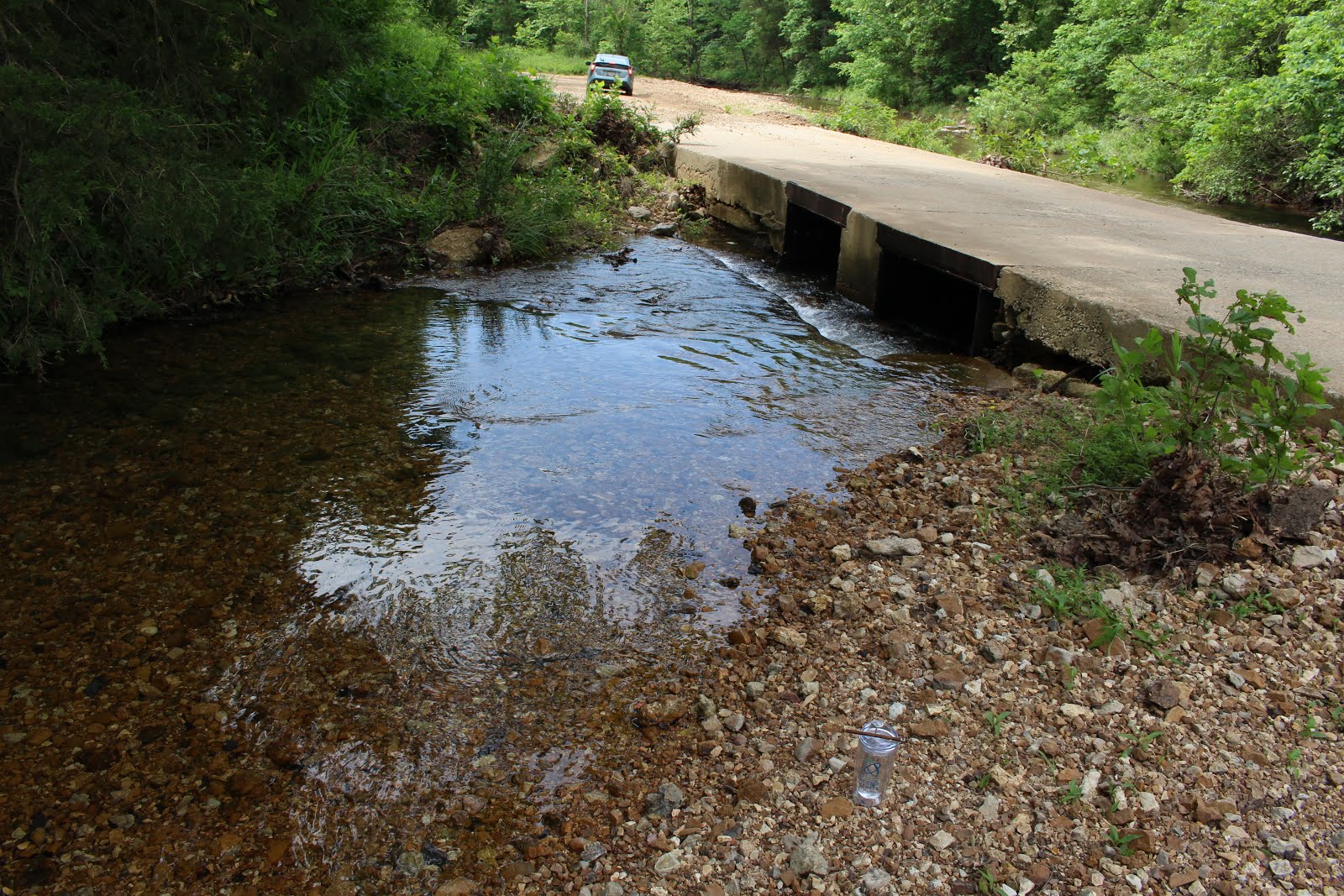
Photo looking west across Blackwell Den Road low water bridge, Warm Springs, Arkansas, downstream and south of the location of the warm spring. The Warm Springs Creek temperature was 66 Fahrenheit at 10:45 AM. The overgrown driveway leading north on the west side of the creek has a dropped cable with a no trespassing sign and many ticks. I talked with a local gentleman in a pickup truck who stopped and talked with me at the bridge after I took this photo. Warm Springs, Arkansas, which now has no services, used to have a theater and hotel. The warm springs were located on the east side of the creek in a building we could see, but was clearly on private property and surrounded by weeds three feet tall. Perhaps the warm water was piped across the creek to the building. We'd tried. It was time to move on.

We then headed north and west to Greer Spring, 56 degrees Fahrenheit at 1:00 PM. Sample was taken near the lower left of this photo.

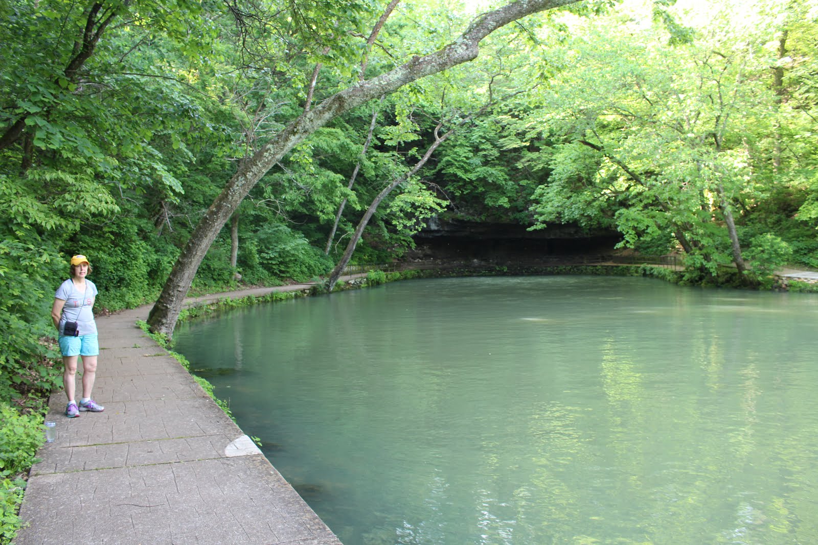
We next headed farther north and west to Alley Spring, 57 degrees Fahrenheit at 3:00 PM. The edges of the spring pool are surrounded by vegetation and dropoffs (a tumbler with a four foot handle would have helped). Sample was taken where my assistant is pointing, where the spring water spills out of the spring pool.

We next drove east to Round Spring, 56 degrees Fahrenheit at 4:00 PM. Sample was taken by the log in the sun on other side of spring in this photo. This spring is much less dramatic than I recall it as a child, but the bluffs above most of these springs are round so my memories of which large springs I saw back then might be more of a composite. There is another pool next to this one with nicer bluffs, but it looked stagnant, and this one has water rising to the surface. The ripples can be seen to the left of the tree in the middle foreground.

The morning of 2019-05-27 we headed to Maramec Spring, 56 degrees Fahrenheit at 9:00 AM. Sample was taken off the edge of the concrete path near lighter concrete patch.
We were unable to locate or sample the warm spring in Warm Springs, Arkansas. The Warm Springs Creek temperatures were 66 degrees Fahrenheit above and below the suspected warm spring location. All cold springs measured were 56 or 57 degrees Fahrenheit. This is lower than the annual average air temperature of about 59 degrees Fahrenheit, and might vary with the season. Measurements at the same locations in, for example, November might be slightly higher than the annual average air temperature. Annual ground temperature extremes lag behind surface temperature extremes, with the time delay increasing, and the amplitude of extreme temperature displacement decreasing, with depth. We saw some huge cold springs and visited two local breweries in Poplar Bluff and Saint James. It was an ambient experience, not a geothermal experience.